


Hefted newsletter #7: January 2025
Despatches from Cumbria and the Lake District, from the team at Countrystride and Inspired by Lakeland
In the first Hefted of 2025: our News Gather features the closure of South Lakes Safari Zoo (and plans for a new animal park in Tebay), new National Parks legislation, Lakeland’s busiest road for parking tickets?, legal action against Ofwat, snowfall in Cumbria and a landmine in Maryport; Mark remembers his old friend AW on a Coast to Coast wander; Alan Cleaver finds Jesus in Eskdale; and Woodland Trust main man Pete Leeson chooses his five favourite Cumbrian woods.
Mark and Dave wish you a very happy 2025.
The gather: Pick of the Cumbrian headlines
South Lakes Safari Zoo has closed. The Dalton-in-Furness attraction made the surprise announcement in mid-December that it would open for the last time on New Year’s Eve. A post on the zoo’s website read: “Well here we are, 31.12.24, the day Safari Zoo opens its doors to the public for the very last time…” The 51-acre zoo was established in 1994 by David Gill, but had courted controversy in recent years with avoidable animal deaths, welfare issues, a keeper’s death and a reported bullying culture. More from The Mail.
Meanwhile, a planning application has been lodged by the former operators of the Safari Zoo to create a “new wild animal reserve” at Brockholes Farm, Tebay. According to planning documents submitted to the Yorkshire Dales National Park Authority, the animal reserve/tourist attraction would consist of a number of animal enclosures alongside shepherds' huts, safari lodges, a café and a welcome centre, with proposed animals including white rhinos, zebras, sloths, giraffes and lynx. Responding to the plans, Tebay Parish Council raised concerns about screening of the buildings from the M6, access from the A685 and the proposal not suiting the “special landscape”. More from the BBC.
Wildlife in England’s most precious habitats could be “disappearing in the dark” because of a lack of regulatory scrutiny. Conservationists have raised the dire state of monitoring at sites of special scientific interest (SSSIs), which cover more than eight per cent of England’s land area (there are around 280 SSSIs in Cumbria). Figures released by Natural England revealed that 75 per cent of sites had no up-to-date assessment. Richard Benwell, chief executive of Wildlife and Countryside Link, said: “With over three-quarters of sites not inspected in the last five years, regulators have no idea whether they are in good condition. Wildlife could be disappearing in the dark while ecosystems break down.” More from The Guardian.
Walkers and access campaigners celebrated a Boxing Day win after the government scrapped a deadline that risked thousands of miles of footpaths. The former government had pledged to repeal a deadline for registering the historic paths, but instead imposed a new deadline of 2031, placing pressure on rambling groups to record over 41,000 miles of unrecorded paths on the definitive map. “The Government’s decision to end the threat to thousands of miles of historic rights of way in England is a fantastic step forward in making sure everyone can enjoy the benefits of walking in nature,” said Ross Maloney, chief executive of the Ramblers. Author Jack Cornish, head of paths at the Ramblers, added: “We've been campaigning for this for many years, and it's wonderful to see the government respond. Happy boxing day walks!” (We have Jack pencilled in for a Countrystride Live event in June, and you can hear him talking about walking from Land’s End to John o’Groats on Dave’s new LEJOGcast podcast.) More from the Ramblers.
In another Boxing Day announcement, which could have major impacts locally, Defra promised new legislation to modernise National Parks. On 16 December, 2024 – the 75th anniversary of the royal ascent of the National Parks and Access to the Countryside Act, which paved the way for designation of the Peak District and Lake District National Parks in 1951 – the government announced it would “work with partners to develop new legislation to empower our National Parks and National Landscapes”. What that looks like in practical terms remains unclear, but with a stated intent to “celebrate the original bold intent of the 1949 Act”, strands of new legislation are likely to focus on nature recovery, climate resilience and a revamp of governance “to ensure it creates the conditions for success, innovation and collaboration”. The Campaign for National Parks (CNP) said it was “thrilled” with the announcement, but noted it would “be holding government to this promise, making sure changes are strong and delivered swiftly”.
Cumbria Wildlife Trust has completed the purchase of 3,000 acres of Skiddaw Forest. The Trust announced its intentions to buy the land, funded by grants from the insurance firm Avivia and £1.25 million in public donations, in August 2024. A 100-year restoration plan to establish England’s highest nature reserve will create “a mosaic of healthy, resilient and revitalised mountain habitats”. CEO of the Trust, Stephen Trotter, said: “We’ve reached another important landmark in the story of Skiddaw Forest: our purchase has formally completed. We’re starting by carrying out in-depth, baseline surveys across the site. In addition, we’ll survey water quality and flow rates, and check the depth and erosion of the peatland.” More from The Keswick Reminder. The Trust’s Jamie Normington talked about the acquisition in the Countrystride End of Year Review.
Wainwright’s Coast to Coast Walk has been named one of the world’s top 25 ‘places to visit’ in 2025 by The Telegraph. The 192-mile long distance walk between St Bees and Robin Hood’s Bay was judged the world’s third “must visit” ‘location’ by the paper’s travel expert Sophie Dickinson, beaten only by Formentera in Spain and Madhya Pradesh, India. “[The path] links the awe-inspiring landscapes of the Lake District, the Yorkshire Dales and the North York Moors,” writes Dickinson. “Since the [Coast to Coast Walk] book first hit shelves, hundreds of thousands of walkers have tramped in Wainwright’s footsteps.” The route will become a National Trail in 2025. More from Times & Star.
The Campaign for National Parks (CNP) is taking legal action against the water regulator Ofwat for “unlawful abdication” of its statutory duties to conserve and enhance wildlife and natural beauty in National Parks. Section 245 of the Levelling Up and Regeneration Act (LURA) 2023 came into force on 26 December, 2023, imposing new requirements on Ofwat, water companies and numerous public bodies to “seek to further the purpose of the landscape designation”. Dr Rose O’Neill, chief executive of CNP, said: “Rivers, lakes and wetlands are the lifeblood of our National Parks. But for too long they have been treated like open sewers. These are places of international importance for nature and for people’s connection with the wild – but Ofwat is turning a wilful blind eye.” More from CNP.
A museum celebrating the life and work of Norman Nicholson could open next year, after plans for its development received the planning green light. Charlie Lambert, from Norman Nicholson CIC, said many people felt Nicholson – the great Millom poet and author who died in 1987 – had been “overlooked”. The museum, at his 14 St George's Terrace former home, will include a café, outreach centre and en-suite accommodation. Our Countrystride episode about the poet can be found here.
More than 1,100 parking tickets were issued to vehicles on a single Lake District road over 10 months in 2024. A Freedom of Information request to Westmorland & Furness Council found that of 26,341 penalty notices given between January and October 2024 – which raised £694,225 in revenue – 1,165 were issued on Glebe Road in Bowness. Christine Hallatsch, of Bowness Town Council, said: “What is urgently needed is a strong vision and leadership by the authorities responsible for tourism and highways such as the Lake District National Park Authority and Westmorland and Furness Council to invest in park-and-ride facilities, and other ways to limit the number of cars coming to the area…” More from Cumbria Crack.
Mountain Rescue teams had a busy Christmas, with teams dealing with three fatalities. The first body was recovered by Langdale and Ambleside Mountain Rescue Team from Grisedale Hause on Boxing Day. A little way west, a search involving 70 team members ended on 30 December with the discovery of a man in his 40s who died after falling 590ft from Helvellyn. Another man died after falling 229ft from Sharp Edge, Blencathra, on 2 January. The callouts ended a record year for both the Keswick and Coniston teams.
High winds and sustained rain impacted on Cumbrian New Years Eve celebrations. In the north Lakes, the third annual Derwent Water dip, organised by Calvert Trust, was cancelled over safety concerns; flooding on the A591 at Bannerigg Farm near Windermere caused extensive delays in both directions; and ‘Act now’ flood warnings were put in place for the River Rothay at Grasmere, and the Rivers Kent and Bela. The undeterred swimmers of Whitehaven still managed their annual ‘Golden Sands’ New Year’s dip.
…and following the major snow dump of 4–5 January, a group of walkers on Scafell Pike were rescued by Wasdale Mountain Rescue (WMR) team suffering the effects of hypothermia. The men, in their 20s, were found “up to their waists in snow”, according to Richard Warren from WMR. Meanwhile, in the Pennines, visitors to Tan Hill Inn – England’s highest pub – found themselves snowed in. Katy Sherrington from Durham drove to the pub with the intention of being stranded at the 1,732ft-high inn: “I’ve been trying to do a snow-in for years but nobody would come with me.” More from The Guardian.
More than 980ft of interlocking shard fencing – the characteristic slate ‘fences’ found around Ambleside, Hawkshead and Coniston – have been restored. While shard fencing is found in other parts of the UK, interlocking fencing – with some slates as tall as five feet – is exclusive to the Lake District. National Park ranger Sara Spicer said the fencing was an “incredible blend of practicality, heritage, and ecological value. For farmers, it provides a durable boundary for livestock. For wildlife, the accompanying hedgerows act as vital corridors, enhancing biodiversity.” More from the BBC.
Cumbria has moved one step closer to getting an elected mayor (and additional devolved funding). At a meeting of Westmorland and Furness Council cabinet, members voted to join the government’s devolution priority programme to create a strategic mayoral authority, while Cumberland Council leader Mark Fryer has reaffirmed his council’s intent to join the programme. If devolution is agreed by all parties, mayoral elections could take place in May 2026. More from the BBC.
In the North Pennines, community attempts to resurrect a historic village pub have suffered a major blow following the government’s rejection of a funding bid. After raising more than £100,000 from supporters, campaigners hoping to re-open the 200-year-old Miners Arms in Nenthead applied for a £360,000 bid from the government’s Community Ownership Fund. Simon Walker, chair of the Miners Arms Community Pub Ltd said he was “disappointed, dismayed, angry, befuddled and bemused” by the decision. More from the BBC.
Labour would take a nationwide hammering but retain its parliamentary seats in Cumbria were an election called today, according to new polling data. Online analyst Election Maps UK said that while Labour would lose more than 100 seats nationally, it would keep all of its Cumbrian constituencies – albeit with tight polling races in Carlisle and Penrith and the Solway. The data also showed long-term Westmorland and Lonsdale MP Tim Farron retaining his seat with a comfortable majority. More from The Westmorland Gazette.
A new year’s treat for frazzled brains is ‘King of the Fells’, a short film about Joss Naylor directed by Seth Whitfield, shot by Kyle Macfadzean and featured on The Guardian website. You can stream the 17-minute film here.
More average speed cameras are being installed along the A66. “Using collision data we’ve identified sections of the A590, A66 and A585 which we think will benefit from measures to slow down drivers and ensure they stick to existing speed limits,” said National Highways project manager Amy Gaskell. Installation of four new cameras along a six-mile section of the A66 between Dubwath and Cockermouth at a cost of £800,000 is expected to be complete by the end of the month. More from The Keswick Reminder.
Lewis and Inspector Morse star Kevin Whately – born in Brampton – has been appointed an OBE in the New Year Honours. The 73-year-old, also known for his role in Auf Wiedersehen, Pet, received the honour for services to drama and charity. More from the BBC.
A burglar has been caught after leaving incriminating dog poo at the scene of his crime. Brian Harold, 20, admitted a string of burglaries and thefts in Carlisle during the month of August 2024. Harold was identified after a poo ‘footprint’ that matched his footwear was left on a victim’s window sill. More from the BBC.
…and finally, three months after an apparent hand-grenade on Cat Bells turned out not to be a hand grenade, a possible land mine on Maryport North Shore turned out not to be a land mine. More from the BBC.
Striding out: Mark Richards’ walk of the month
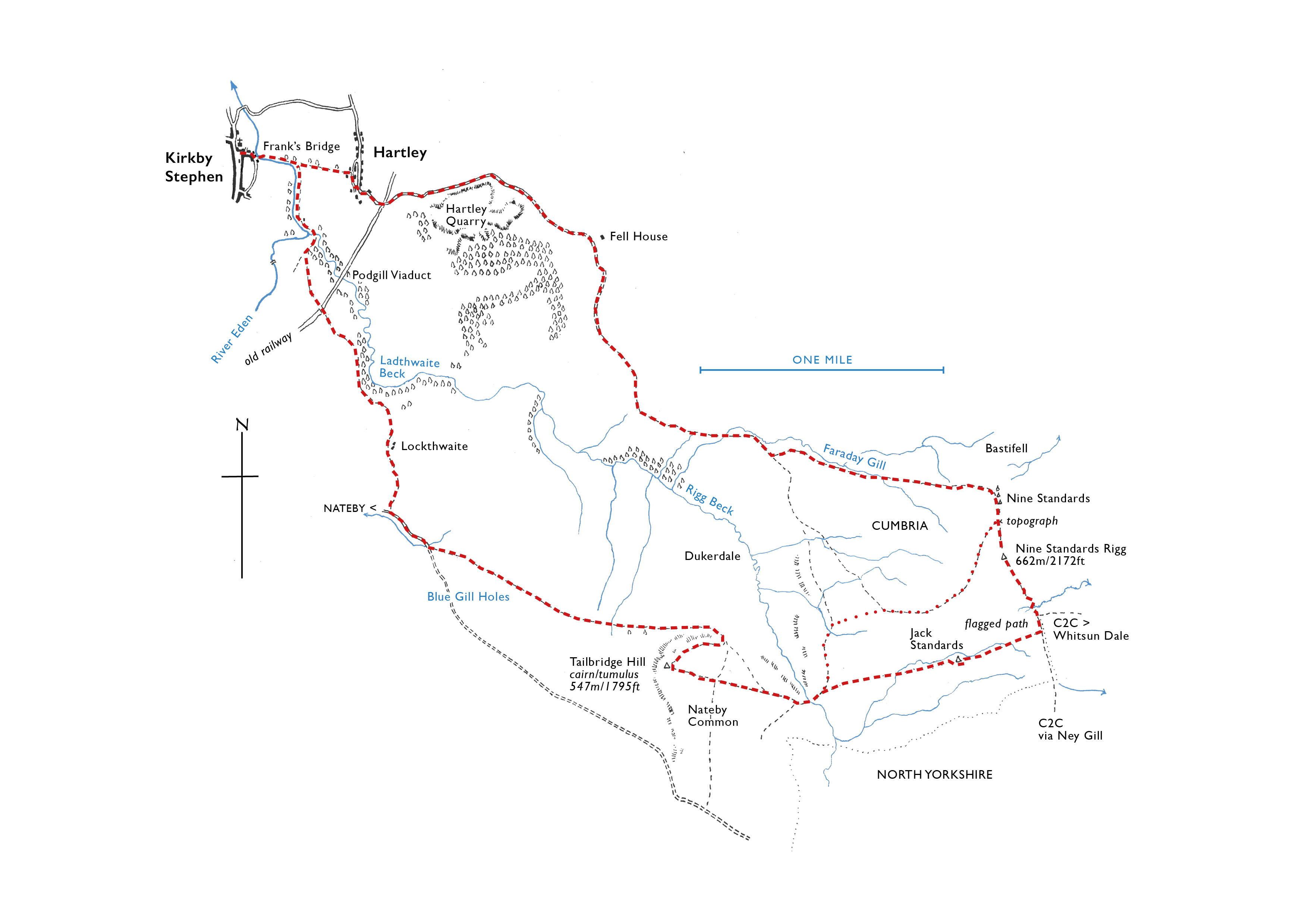
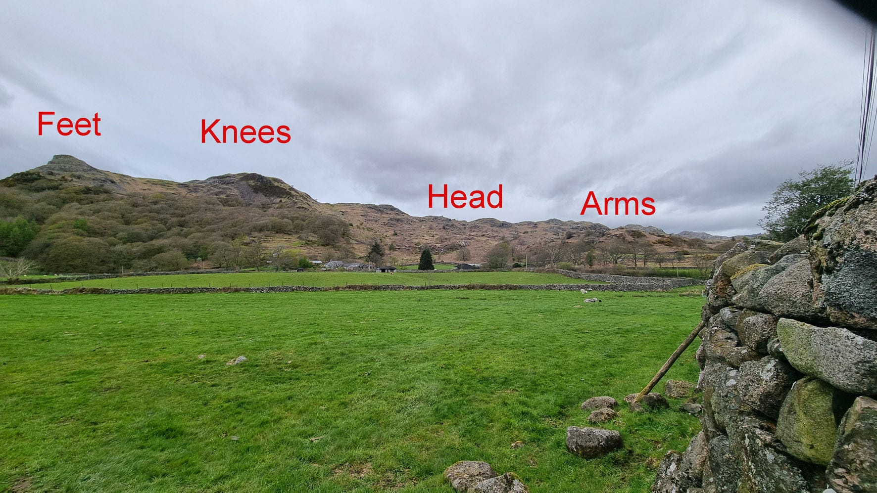
Nine Standards Rigg from Kirkby Stephen – 10 miles, 1,900ft ascent, 7 hours
Celebrating the year that A Coast to Coast Walk becomes a National Trail, Mark takes a Nine Standards trip down memory lane to recall the Pennine walks he did a half-century ago with his friend and mentor, Alfred Wainwright.
Casting my mind back to the second Saturday of March 1972 is quite an ask.
But I have sufficient memories from that day to play into a description of a walk I did one bonny winter’s afternoon at the tail end of 2024 from the Walkers are Welcome town of Kirkby Stephen.
To many people, this upper Eden community is the Keswick of east Cumbria – a walking capital with a variety of scenically engaging expeditions high and low. It is also a crossroads of long-distance footpaths; here the Pennine Journey and Coast to Coast Walk cross.
Turning the clock back 50-odd years, that March day was one of patchy snow drifts and furtive mists, which obscured the views as I walked with Betty and Alfred Wainwright from the fell road-end above Hartley via Faraday Gill to the Nine Standards and back. I was then in my early 20s, and eager to learn how to plot and write up routes from the grandmaster of guidebooks himself.
I had walked with AW on two occasions prior to that chilly day – over Beacon Hill above Orton and by Smardale Bridge near Ravenstonedale. Both rambles were undertaken as research for a new-concept long-distance route across northern England. That route would become his Coast to Coast Walk.
AW never did undertake his 192-mile cross-country route as a single journey; not during his research, nor in later life, when he would – of course – have had to rub shoulders with his own rambling disciples. Instead he ventured out on short linear there-and-backs chauffeured by Betty in her little green VW Beetle. AW took the front passenger seat, and I can still smell the Three Nuns tobacco that he puffed on as we rattled round the Dales.
I spent a dozen or so weekends with AW and Betty during the first half of the 1970s, walking with them on trips to capture photos, and checking routes for various other book projects he was engaged in. I was in a privileged position, even if – youth being what it is – I did not realise it at the time.
AW started his Coast to Coast Walk research by rambling east from Richmond to Robin Hood’s Bay – virgin territory to him. He knew if he could make that stage work then the journey west from St Bees would fall into place. I did two further walks in Swaledale with AW, the first from Keld to Gunnerside Gill via Crackpot Hall and back, the second from Reeth to Marske and back, which was the last stretch of research AW did.
Those convivial memories came back anew as I re-trod old steps. This time I journeyed alone; the only walkers I met were a family descending from the Standards and a few dog walkers on the locals’ path from Frank’s Bridge to Hartley. A peaceful day ensued.
As the fell road turns to track and leads through a gate onto the open fell, the trail accompanies the intake wall bounding Dukerdale. ‘Duker’ is, of course, the dialect name for a dipper.
The route bears left where the wall veers right, ascending the southern bank of Faraday Gill, where two soggy stretches are destined for attention by Cumbria County Council as the path hastens on its status transition from ‘A Coast to Coast Walk’ to ‘Coast to Coast Path National Trail’, as approved in 2023 by then-Prime Minister and MP for Richmond Rishi Sunak.
(Sunak is not the only Tory MP to have had a soft spot for the trail, incidentally; Theresa May famously gifted then-German Chancellor Angela Merkel a copy of the Derry Brabbs coffee-table book Coast to Coast with Wainwright when she was PM, along with Terry Marsh’s Great Mountain Days in Snowdonia, the Welsh equivalent of my own Lake District Mountain Days title.)
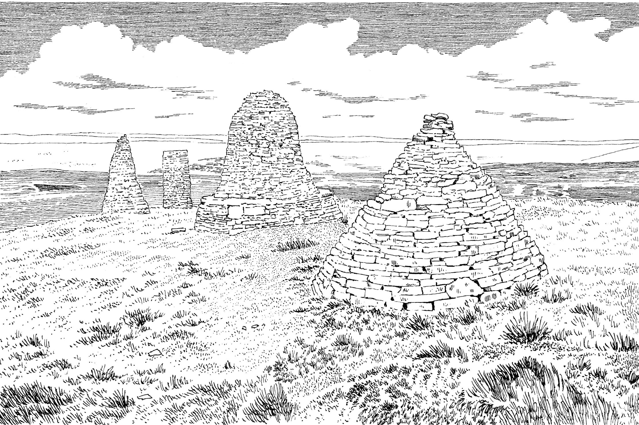
The ‘Standards’ themselves – nine handsome cairns – mark the crown of a dry spur of Hartley Fell. They were rebuilt in 1918, and in 2005 five were rebuilt again, the other four stabilised, securing them for a few more decades against the visitations of wild Pennine storms and the Helm Wind, which whips down the western slopes into the Eden valley.

Why these obelisks were built is largely a mystery; were they old beacons, or way-markers or – more fancifully perhaps – to simulate an army’s transient encampment? They are, though, curiously Pennine. Similar cairns stand atop Wild Boar Fell, looking down over Mallerstang, on Bough Fell above Garsdale, and in profusion on Abbotside Common above the Wensleydale hamlet of Hardraw. Perchance I also have a replica parade on the fell above my Geltsdale home, Talkin Fell, with double the number of curricks (that term, incidentally, derives from the Brythonic careg, reflected in the village name Castle Carrock).
What unites all of these sites is the commanding views from the stone men of old, and from Nine Standards Rigg the panorama includes the length of the Eden Valley, flanked by the highest Pennine hills, east, and, west over the gulf of Eden, the long line of Lakeland’s far-eastern fells. Nearer at hand, the rounded Howgills and Wild Boar Fell flank lovely Mallerstang (the evocative valley name means ‘boundary post’).
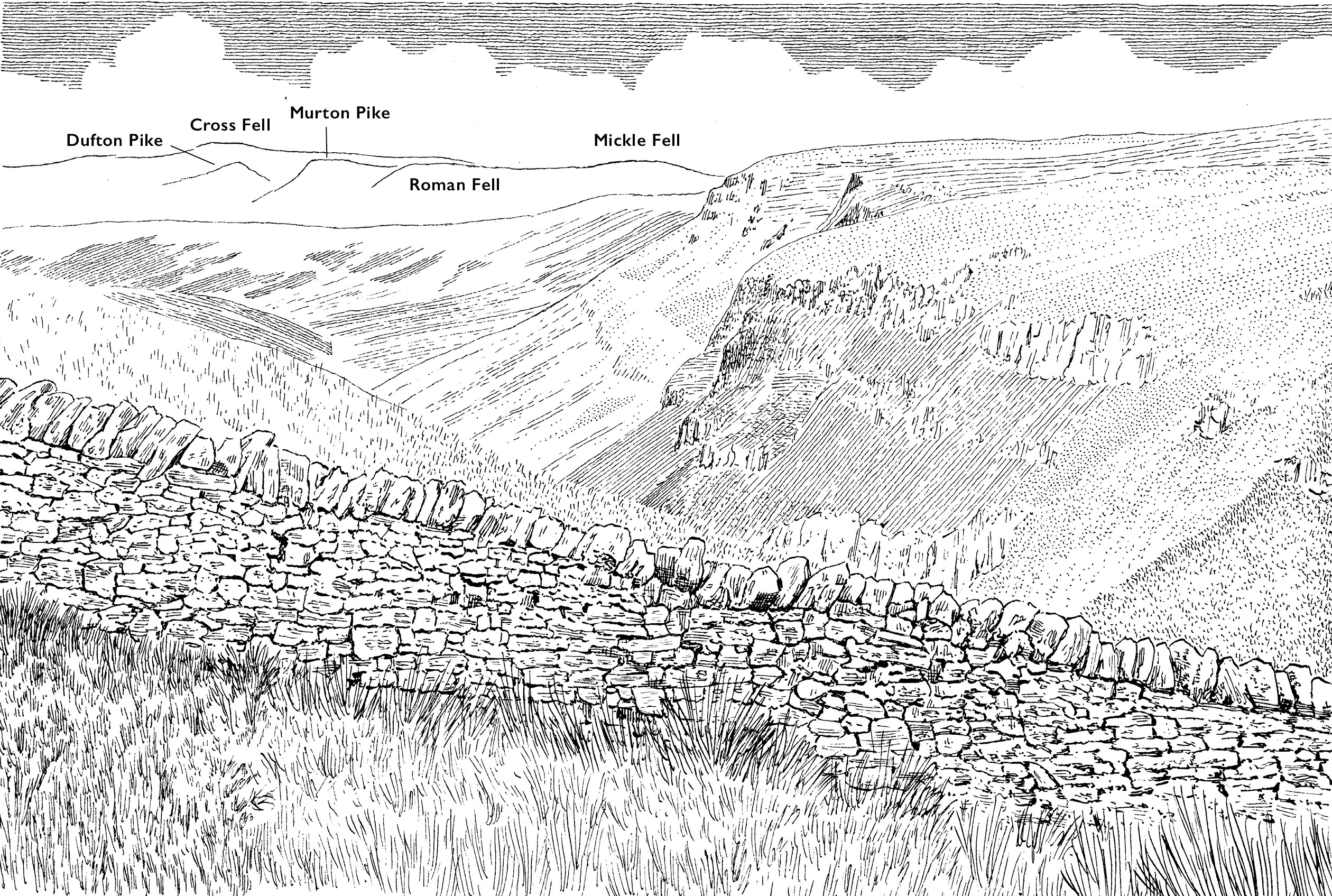
Leaving the Standards behind, I trod on past the summit trig column at 2,172ft, espying the wool bung rolls set in the soggy ground to reduce surface run-off, soon to come onto a procession of recently-laid stone flags – a feature for many more years along the plateaued morass where plods the Pennine Way north from Edale.
These flags would have reminded AW of the mill town working environments that he sidestepped from his home in Blackburn by embracing books and being cute with numbers. He would go on to work in the town council offices as a clerk and later, moving north, rising to become the Town Treasurer of Kendal. A society man – in one sense of the word, at least.
I should have been content to skip off the ridge from the topograph, where a clear path trends right, drifting down the western slope to come back into harmony with the intake wall above High Dukerdale – the recommended route from December to April for the C2C Walk.
However to my chagrin, I plodded on, passing the stone marking the county divide ‘Y’ (North Yorkshire) and ‘C’ (Cumbria) where Wainwright’s chosen direct path to Whitsundale Beck trends east. The continuing flags duly peter out, with the continuing moorland path leading south, destination Ney Gill.
Jack Standards was my next intended destination – more for curiosity than scenery. It turned out not to be a clever idea at all, the traverse of spongy moorland bad for the mosses and wretched for me. The rocky outcrop of solitary Jack Standards presented welcome respite before the damp resumed; the way down to the intake wall at the head of Dukerdale was an unrelenting swathe of rushes, and no place for walkers. I have shown my route (in dashes), but should you wish to undertake this walk, I beseech you to follow the dotted route.
Crossing Dukerdale Beck, the path proceeds to corner the wall at Dukerdale Pots, the name an indication of the transition to limestone bedrock, with the promise of dry ground. From here a short passage leads to the cairn-topped grassy tumulus of Tailbidge Hill, another fine viewpoint, visited by casual walkers from the high point of the road from Nateby to Swaledale via Birk Dale.
Bear right here (northeast), curving down to follow a quad track that traces the intake wall to an unenclosed road, which is followed to where a footpath directs right along a cul-de-sac to Lockthwaite. Bear left before the dwellings through a gate, then angle right along a footpath past a lonesome barn to cross the old Stainmore Railway at a curious double-gangway bridge. The Stainmore Line opened in 1861 as the South Durham and Lancashire Union Railway to transport coal.
Coming down to join a path from Nateby, seek out the Discover Eden post featuring Pippa Hall’s quaintly beautiful Loki design. To discover the significance of this motif, end the walk by passing through the Waller pavilion into the churchyard and look inside the wonderfully large parish church, where the Loki stone – or Bound Devil – confronts you as you enter. Loki was an eighth-century Norse God, and the stone here is one of only two known in Europe.
When I completed my walk with Alfred and Betty on that chill March day in 1972, we called in at Kirkby Stephen’s North Road fish and chip shop, which, after AW’s guide was published changed its name to celebrate the route.
In many ways it is as fitting a tribute to my ex-fellwandering (and fish and chip-loving) friend as the National Trail status of his Coast to Coast Walk.
Mark is author of four Countrystride Walking Companions, each featuring dozens of walks, line illustrations and insights into local landscape, history and heritage.
‘The Pimp’*: Five of the best…
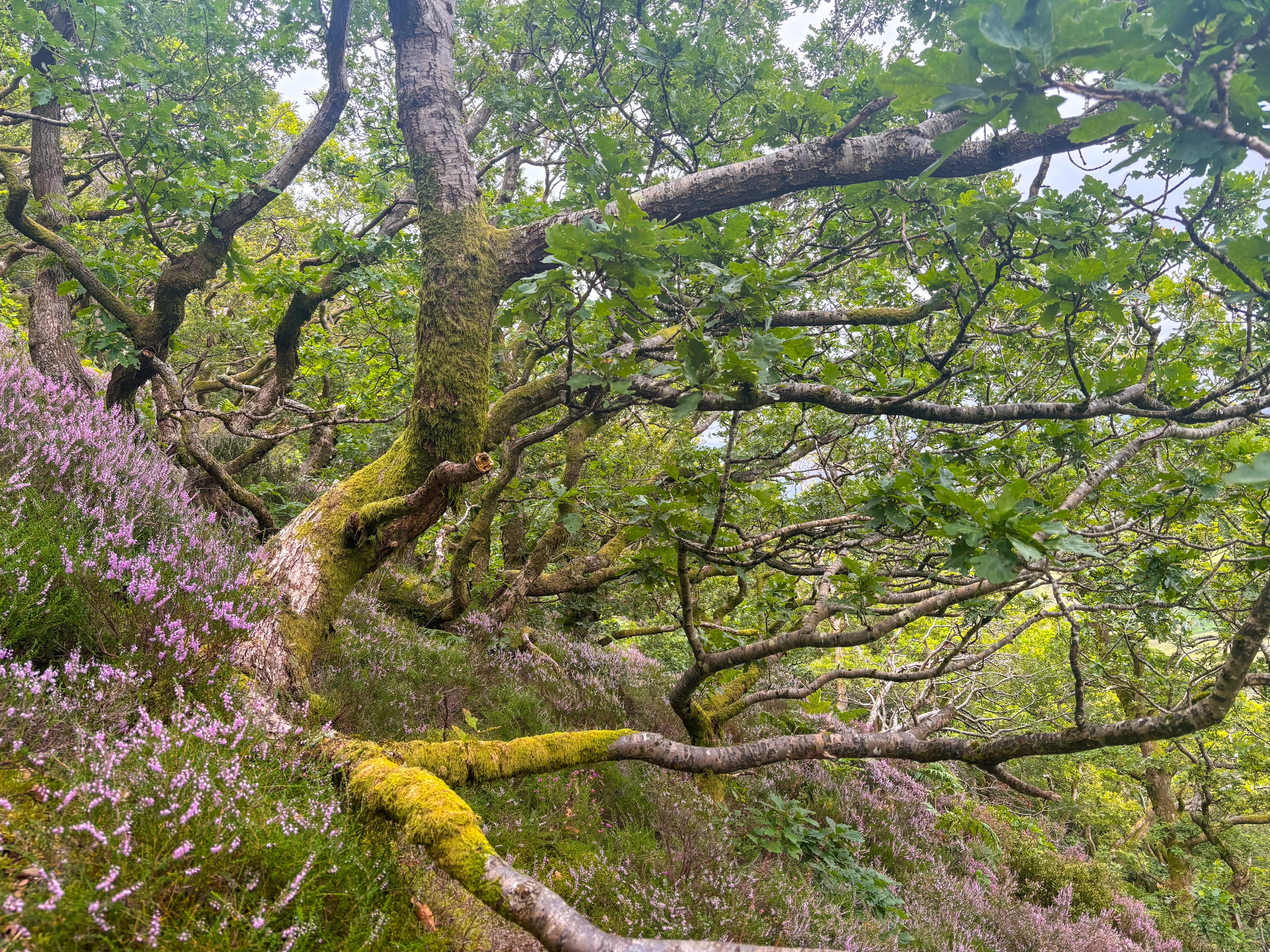
Cumbrian woodlands
As picked by Pete Leeson, the Woodland Trust’s main man in Cumbria.
#1. Sea Wood (Bardsea, south of Ulverston) – Woodland Trust
Sea Wood, owned and managed by the Woodland Trust, lies on the northwest shore of Morecambe Bay and is edged by the shingle beach of Ulverston Sands.
It is an ancient woodland site, which means we know it has been continuous woodland since at least the first reliable map series were produced in around 1600.
Continuous woodland cover means the site has soils that likely date back to the last Ice Age. These support a wealth of fungi, lichen, mosses and soil fauna, which are typical of sites that have never been farmed.
A visit here ticks a seaside and woodland experience in one. It is amazing to walk along the beach and look into old oak woodland and imagine how the whole estuary might have looked in the centuries after the ice retreated. Visit in late May for a wonderful show of bluebells.
#2. Whinlatter Forest, Braithwaite – Forestry Commission
Perhaps surprisingly for someone who spends so much time advocating for native woodland, I love the predominantly conifer-planted expanse of Whinlatter Forest.
Woods don’t have to be ancient to be loved. They play a key role in facilitating public access to the countryside, and Whinlatter is not only really accessible – just a stone’s throw from Keswick, with walks and bike trails that take you high above Braithwaite – but its scale means you can stride out for hours through contiguous woodland, which is a rare thing in England.
The real prize in this forest is to be found just north of Seat How at the 500 metre contour, where a pocket of stunted trees – low, wind-shaped and dripping with great tresses of lichen and moss like the ancient forests in Lord of the Rings – have the appearance of rainforest.
Public recognition of temperate rainforests has increased significantly in the UK over the past few years, not least since the publication of Guy Shrubsole’s The Lost Rainforests of Britain. This special habitat – which is at greater risk even than tropical rainforests – clings to the wet western seaboard, with pockets from the northwest of Scotland through Cumbria and down into Cornwall.
Borrowdale is the Lakeland stronghold of ancient, broadleaved rainforest, but given the accessibility of Whinlatter, people who might not normally delve deep into woods can experience a zone typical of temperate rainforest, with high humidity created by near-constant cloud coupled with regular and large amounts of rain. Establishing new broadleaf woodland at altitude is tough, and I often wonder whether rainforest restoration could be kick-started using non-native species.
#3: Tebay Common (southwest of Tebay) – Lonsdale Estate / Tebay Commons Association
Taking a walk in a young wood can be a really energising experience – particularly if you knew a site before the trees went in.
Over the past two decades, I have had the pleasure of working on a landscape-scale restoration project at Tebay that kicked off in 2009. In collaboration with the landowners, local farmers and Natural England, around 250 acres of fenced areas have been planted with new scrub woodland and excluded from stock, including around Tebay Gill, a mile uphill from the village.
Scrub is a term many use to describe areas which are badly managed or abandoned – perhaps with gorse and thorn rather than larger trees or traditional woodland – but as a habitat, it’s dynamite!
Our design for the new scrub woodland left lots of woodland edges and open spaces, which are now recovering beautifully with bilberry, crowberry and heather. As a result this patchwork of young trees and heathland plants is being colonised by numerous birds. Monitoring has shown that before the project started there were just five breeding bird species on site. Over the course of a decade that number increased to 14, with colonisation by willow warbler, stonechat whitethroat and others.
In the long-term, selective grazing will be re-introduced around Tebay Gill to keep areas open and scrub in check. I have grown to love the complex stages of change in habitat restoration projects and now see the value in disturbance and change as an ecological process in its own right.
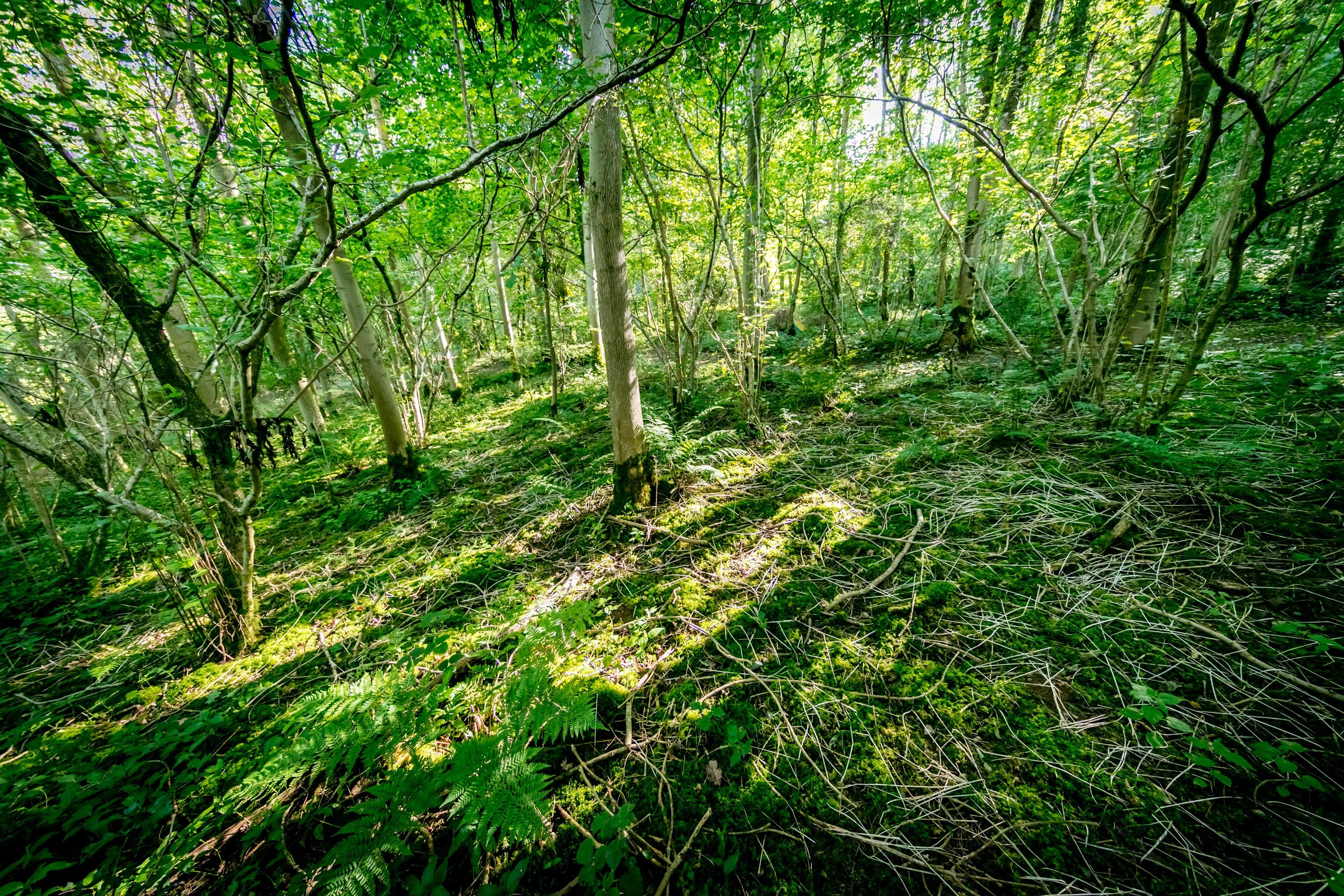
#4: Young Wood (Mungrisdale)
From young woods, to Young Wood, this narrow slither of woodland above Mungrisdale is distinctly challenging to visit, rising as it does on the steep slopes of Bowscale Fell. Indeed the wood’s inaccessibility – clinging high above a scree field – is perhaps why it has survived where so much woodland of its type has been lost.
The severity of the landscape here – it is all poor soils and exposure – has created a gnarly forest of Lilliputian dimensions; a six-foot tall visitor can look down on parts of the canopy as if they were a giant.
A visit to Young Wood – or similar woods like Keskadale or Birkrigg above Newlands (pictured above) – is always tinged for me with ‘what if’ questions; what if we could give this wood space to expand and grow?
That question matters because a wood this small could be lost so very quickly – and with barely a whisper – yet it is stunning, valuable and a rare throwback to a time when our uplands were far more wooded than they are today.
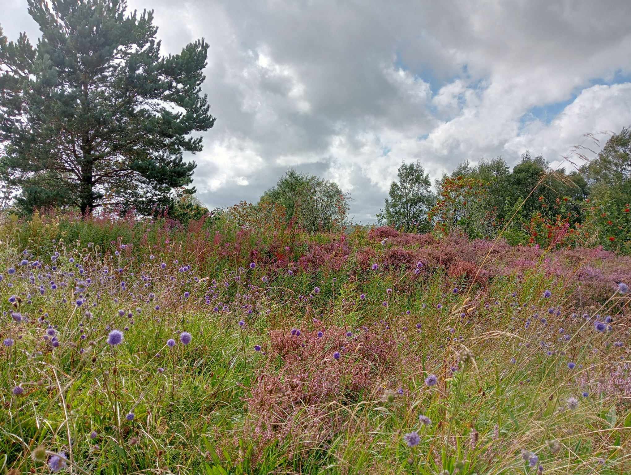
#5: The woods of Swindale (west of Shap) – Managed by RSPB
I rarely think of woods in isolation, so my fifth wood is not a single wood, but a wooded landscape.
In my ideal world our whole landscape would allow for the movement of plants and animals through connected flowering, scrubby, tree’d and wetland habitats. Swindale demonstrates this to near-perfection, blending low-intensity (traditional) farming with positive (up-to-the-moment) landscape management, like the restoration of Swindale Beck to its old meandering course.
The valley has trees of all ages, dotted through a patchwork landscape of wildflowers and wetlands. Small woods climb the fells above areas of wood pasture featuring ancient open-grown trees.
I like to come here in spring to listen to the birdsong, but also to hear the buzz of insects. A winter walk has its own rewards, revealing the hidden colours of the season – the pale bark of ash set against the ruddy red buds and upper stems of silver birch.
Pete has worked at the Woodland Trust for over 30 years, carrying out a number of roles which have taken him across the north of England, Northern Ireland and into Scotland. A chartered surveyor, he spends his time working with landowners to help them restore and improve wildlife habitats. His Tree Amble podcast tells positive stories about land management.
* For the avoidance of doubt, ‘pimp’ is the number five in Cumbrian dialect.
Cumbriana: The hidden figure in Eskdale
A column of curiosities, with Alan Cleaver
I always considered that I knew Eskdale reasonably well, as it is the valley closest to my Whitehaven home, and the one where my wife Lesley and I walk most frequently. So it was a nice surprise last year to stumble across two new nuggets from its past which I had not before discovered.
They were buried in the notebooks of the late Rev. W. S. Sykes, who was vicar in the valley church of Saint Catherine’s and at Millom at the turn of the 20th century.
He included in his notebooks the Eskdale Christmas carol. That was a wonderful discovery in itself, but the carol also made mention of a number of local landscape curiosities, including “her holy well”, “a narrow lownin [lonning]” and – more mysteriously – “a figure stretched across a fell”.
Here’s the first verse:
What shall we sing, what shall we sing
As a cradle song for our baby King?
Of a lonely Dale and rough stone walls
And the music of many waterfalls
Of St Catherine’s Church and her holy well
Of a figure stretched across a fell?
Of a narrow lownin and lichen grey
And Dalesfolk tramping the churchward way
Is this a song he would like to hear
If we sing with voices sweet and clear?
The holy well is St Catherine’s holy well, located a quarter-mile east of the church (and signposted from the church). The well is sadly now in poor condition, roots of a birch preventing its spring water from flowing freely.
The lonning is Parson's Passage, a footpath leading from the old vicarage to the church, and one of many fine old ways in the valley.
But the “figure stretched across a fell”… this was new to me.
The diary included a note to say that this enigmatic ‘figure’ – Christ lying on the cross – was to be found in resting profile along the fell edge at Christcliff (Christcliff lies beyond the village of Boot, just opposite Hows Wood).
I was intrigued, and at the earliest opportunity Lesley and I set out to see if we could make it out.
There are many rocks in the Lake District that have been interpreted as holding the likeness of a person or animal: Sphinx Rock, Badger Rock, the Lion and Lamb. And if you look hard enough, Christcliff does indeed look like a figure lying on a horizontal cross.
Did this enigmatic figure in the fells inspire the name of the crag, or is that coincidence? We will likely never know, but it is another landmark to look out for when exploring this beautiful part of the Lake District.
You can follow Alan on Twitter/X at x.com/thelonningsguy